A strong nor’easter will bring heavy snowfall, strong winds, and treacherous travel conditions to Atlantic Canada this weekend. The storm is currently developing and warning signs on the mainland of Nova Scotia, Prince Edward Island as well as southeastern New Brunswick might affect the timely departure of the holiday travelers.
Snowfall Warnings and Regional Impacts
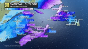
Canada’s environment office weather services have colored the snowfall warnings predicting a 15-30 cm snow blowing from Friday night through Saturday evening. Southern New Brunswick and the Nova Scotia mainland are more likely to experience worst of the storm while Cape Breton is held under the Special Weather Statement for probable freezing rain mixing with the snow. To emphasize the warnings, Prince Edward Island has been given a Winter Storm Warning with 25 cm of snow that may fall together with rain and the wind gusts may reach 80 km/h making the roads hardly visible.
Snowfall Totals by Region:
- Mainland Nova Scotia and Southeastern New Brunswick: Along with the snow of 15-30 cm, it as well is expected that it will drift due to the wind, especially locally.
- Cape Breton: 5-15 cm of snow, mixed with ice pellets and rain.
- Prince Edward Island: Up to 25 cm of snow with strong winds, increasing whiteout risks.
- Northern and Western New Brunswick: Lighter snow is to fall which is expected.

Source: CTV News Atlantic
Travel Disruptions: Plan Ahead
Heavy snow combined with gusty winds will lead to slippery roads and reduced visibilities to create hazardous travel conditions. Non-essential travel is discouraged during the peak of the storm which will be late Friday night through Saturday morning. Motorists are urged to be prepared for fast deteriorating road conditions as well as stay tuned to Environment Canada for updates.
Safety Tips:
- Check for Winter Parking Bans, Have Snow Removal Equipment Ready.
- Charge your devices in advance in case the power goes out.
- Avoid travel unless absolutely necessary during the height of the storm.
Stronger Wind Gusts Increase the Intensity
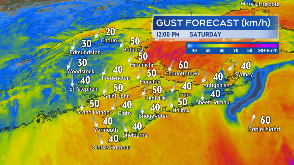
Strong northerly winds with gusts between 60-80 km/h over exposed areas of Prince Edward Island and coastal Nova Scotia will also accompany the storm. The winds, along with falling snow, will create blowing snow and the possibility for localized power outages. Winds by Saturday afternoon should shift to the northwest and gradually subside by Sunday morning.
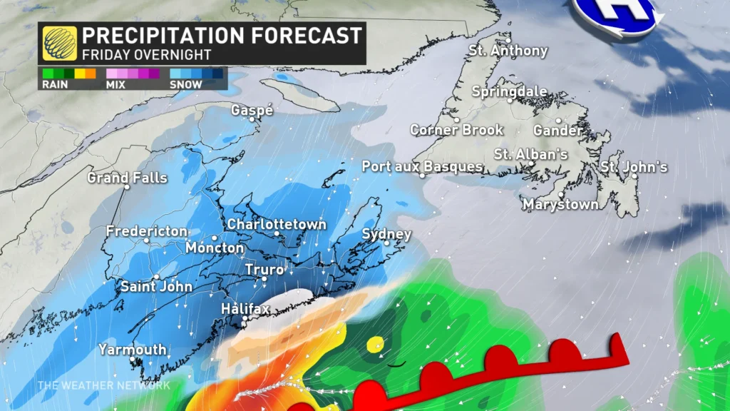
Intensification of Winter Storm-Detailed Forecast

Source: The Weather Network
Key Regional Impacts:
- Western Newfoundland: Heavy snowfall by Saturday morning, with freezing rain moving northwest.
- Rain is the most common kind of precipitation in eastern Newfoundland.
- Gander to Port aux Basques: Snow, slush, and ice.
Source: The Weather Network
Long-term Weather Outlook
Stay weather-aware and prepared.
As this powerful winter storm approaches, remain alert; continue to monitor Environment Canada and local authorities’ announcements for updates on safety throughout this dynamic weather event.


